AMOS (Aerodrome Meteorological Observation System)
The AMOS is the primary equipment for aeronautical meteorological observation, automatically measuring, processing and disseminating weather data such as wind direction and speed, visibility, runway visual range (RVR), cloud height, air temperature, dew point, atmospheric pressure and precipitation over the runway complex.
 Wind direction, Speed
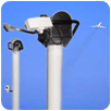 Runway Visual Range
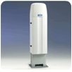 Cloud height
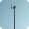 LLWAS
LLWAS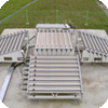 Wind Profiler
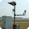 Current weather/temperature, humidity
TDWR (Terminal Doppler Weather Radar)
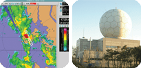 The TDWR enables early detection of significant weather phenomena such as heavy rain, snow, wind shear, microbursts, and gust fronts, which may create conditions hazardous to landing or departing aircraft, for distribution to air traffic controllers and other related users.
Windshear Alert System
LLWAS (Low Level Windshear Alert System)
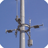 LLWASThe LLWAS detects wind shear and microbursts by analyzing fluctuations in the wind based on real-time wind data from the wind direction/speed sensors installed along the runways.
Information on wind shear and microbursts is transmitted to the control tower along with an alert signal, both of which are subsequently relayed to landing and departing aircraft. AMO operates LLWAS equipment at the airports in Incheon, Yangyang and Jeju.
Wind Profiler
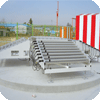 Wind ProfilerA wind profiler is a Doppler radar that detects wave signals scattered back from clouds, rain particles, or turbulence, thus capturing the vertical profile of the atmosphere and wind field.
This system is in operation at the airports in Ulsan, Gimhae and Yeosu.
IWHU (Integrated Weather Host Unit)
 The IWHU is an integrated system for managing the real-time collection, analysis, processing, display, dissemination, and delivery of products for aeronautical meteorological services. This computation and communication equipment is operated in dual mode for a stable, real-time information delivery.
WAFS (World Area Forecast System) Products Receiving System
 Pursuant to ICAO Annex 3, AMO operates a receiving system for products from the World Area Forecast System (WAFS), which provides area/route forecast of upper air wind/temperature (WINTEM) and significant weather forecast (SIGWX) to international airlines.
WAFS products are received from Washington (ISCS) via satellite.


